VVestiges of New York49,000+ historical photos
MapBrowseAboutGet the iPhone app (opens the App Store)
  1. Browse /
  2. Manhattan /
  3. This place

Cherry Street & Roosevelt Street, Manhattan

17 historical photos taken here between 1906 and 1936, oldest first.

See this spot on the map

Photos

  • Manhattan: Cherry Street - Roosevelt Street, 1906

    Manhattan: Cherry Street - Roosevelt Street

    1906

  • Manhattan: Cherry Street - Roosevelt Street, 1922

    Manhattan: Cherry Street - Roosevelt Street

    1922

  • Manhattan: Cherry Street - Roosevelt Street, 1925

    Manhattan: Cherry Street - Roosevelt Street
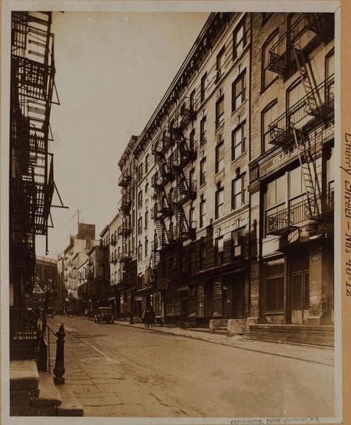
    1925

  • Manhattan: Cherry Street - Roosevelt Street, 1925

    Manhattan: Cherry Street - Roosevelt Street

    1925

  • Manhattan: Roosevelt Street - Cherry Street, 1927

    Manhattan: Roosevelt Street - Cherry Street

    1927

  • Manhattan: Cherry Street - Roosevelt Street, 1927

    Manhattan: Cherry Street - Roosevelt Street

    1927

  • Manhattan: Cherry Street - Roosevelt Street, 1932

    Manhattan: Cherry Street - Roosevelt Street
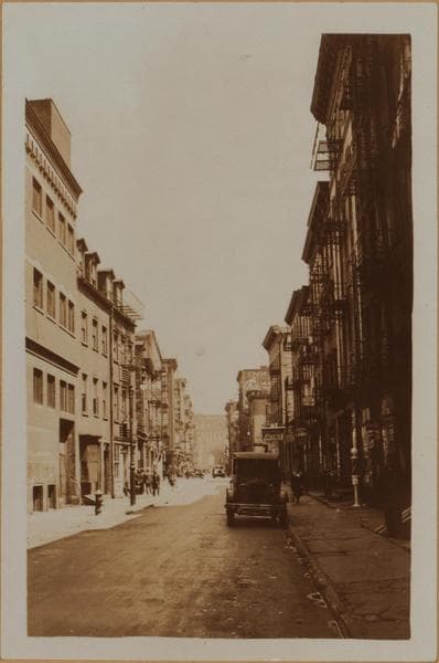
    1932

  • Manhattan: Cherry Street - Roosevelt Street, 1932

    Manhattan: Cherry Street - Roosevelt Street
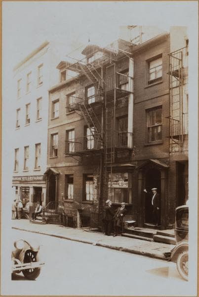
    1932

  • Manhattan: Cherry Street - Roosevelt Street, 1932

    Manhattan: Cherry Street - Roosevelt Street

    1932

  • Manhattan: Roosevelt Street - Cherry Street, 1933

    Manhattan: Roosevelt Street - Cherry Street

    1933

  • Manhattan: Roosevelt Street - Cherry Street, 1933

    Manhattan: Roosevelt Street - Cherry Street

    1933

  • Manhattan: Roosevelt Street - Cherry Street, 1934

    Manhattan: Roosevelt Street - Cherry Street

    1934

  • Manhattan: Cherry Street - Roosevelt Street, 1936

    Manhattan: Cherry Street - Roosevelt Street

    1936

  • Manhattan: Cherry Street - Roosevelt Street, 1936

    Manhattan: Cherry Street - Roosevelt Street

    1936

  • Manhattan: Roosevelt Street - Cherry Street, 1936

    Manhattan: Roosevelt Street - Cherry Street

    1936

  • Manhattan: Cherry Street - Roosevelt Street, 1936

    Manhattan: Cherry Street - Roosevelt Street

    1936

  • Manhattan: Roosevelt Street - Cherry Street, 1936

    Manhattan: Roosevelt Street - Cherry Street

    1936

Stand where these photos were taken

The free OldNYC app for iPhone centers the map on you and shows the historical photos taken closest to where you are.
Download on the App Store (opens the App Store)
QR code that opens OldNYC on the App Store

Or scan with your iPhone

Nearby places

  • Cherry Street & James Street, Manhattan (34 photos)
  • South Street & Roosevelt Street, Manhattan (36 photos)
  • New Chambers Street & James Street, Manhattan (8 photos)
  • Roosevelt Street & Oak Street, Manhattan (18 photos)
  • South Street & James Slip, Manhattan (17 photos)
  • Cherry Street & Catherine Street, Manhattan (22 photos)
  • Hague Street & Pearl Street, Manhattan (4 photos)
  • Monroe Street & Catherine Street, Manhattan (25 photos)

Explore

  • Map
  • Browse by place
  • Browse by decade

Boroughs

  • Manhattan
  • Brooklyn
  • Queens
  • Bronx
  • Staten Island

About

  • About and contact
  • Privacy

Photos: The New York Public Library, Milstein Collection

OldNYC for iPhone

Find the historical photos taken closest to where you stand.

Download on the App Store (opens the App Store)QR code that opens OldNYC on the App Store
Manhattan: Cherry Street - Roosevelt Street, 1906

Photo 1 of 17 at Cherry Street & Roosevelt Street, Manhattan

Manhattan: Cherry Street - Roosevelt Street

1906

Cherry Street, east from (No. 24, left margin), a point between Franklin Square and Roosevelt Street, and to the latter, showing a slum area, long known as Cherry Hill and in which numerous sociological studies have been conducted. Irrespective of same, it still has a similar appearance in 1938, although several of the buildings on the right have been demolished as part of a slum clearance project under the joint auspices of the City and the Works Progress Administration. Included in same was the demolition of No. 29 1/2 which is reputed to be possible the oldest structure in Manhattan, containing from the writers personal observation old Dutch brick, same being half the present size and composed of yellow clay. Note the narrow walks and the cobblestoned street bed, the latter sloping downhill with horse drawn vehicles there upon. forming the contour which has given this area its name. Several gas lamps appear in conjunction with numerous saloons and former residences converted into tenements. Urchins in the foreground are the progeny of the inhabitants of the squalid buildings lining this street. These differ radically from the former residents who in their day formed the select of the City; No. 1 being the first Presidential residence. A tablet to this effect is now attached to the base of the Brooklyn Bridge at this point. "Boss' Tweed is humorously reported by Dennis Lynch, in his book bearing that title, to have offered to donate the funds to erect a church there, stating it to have been his birth place. True or false, it is a fact that he was born on this street, as was his father.

Photo from the New York Public Library - Milstein Collection

See this spot on the mapView on NYPL Digital Collections (opens in a new tab)

See this photo in high resolution

Zoom into the full-resolution scan in the OldNYC app for iPhone with OldNYC Supporter ($4.99). The free app also centers the map on you, so you can find the photos taken closest to where you stand.
Download on the App Store (opens the App Store)
QR code that opens OldNYC on the App Store

Or scan with your iPhone